IMTraveller
Trip Planning Made Easy Many of us love to [...]
Trip Planning Made Easy Many of us love to [...]
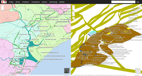
This project aims to establish a web-based 3D Geo-data Modelling and Management System (GeM2S) that will lead to cost savings and increased productivity for future infrastructure or underground construction projects in Singapore. A large amount of geological borehole data and geotechnical testing data has been obtained over the years from various types of projects. GeM2S can turn these data into a valuable resource to guide future underground developments in Singapore, saving developers a considerable amount of money and time.
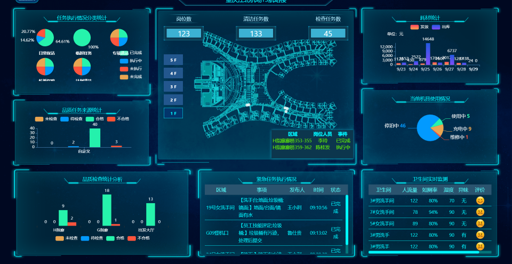
Smart Aviation Service Information Platform improve airport management level and support capabilities holistically. The main functions include service personnel management, cleaning process management, dispatch monitoring center, material management, equipment management, dashboard function etc.
")
Partners
Mapbox
Bentley
Get3D
Contact
info@onegis.com.sg
#01-08, LaunchPad
75 Ayer Rajah Cres, S139953