TRACK RECORD
10+ years
Delivering geospatial solutions across Southeast Asia and China.
QUALIFIED TEAM
30%+
Of our team are GIS specialists with a bachelor’s degree or higher.
PUBLIC-SECTOR END-USERS
LTA · PUB · NEA · BCA
Healthcare facilities Successful deployments with Singapore’s agencies.
Healthcare facilities Successful deployments with Singapore’s agencies.
ACADEMIC R&D
NTU · Wuhan University
Research partnerships in geospatial and civil engineering.
TECHNOLOGY PARTNERS





01PRODUCTS
Geospatial products built from real deployments
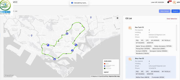
Three platforms that bring spatial intelligence into daily operations — from on-premise AI to indoor navigation and field-service dispatch.

02CAPABILITIES
From underground space to city-scale digital twins
We serve transportation, utilities, construction, environmental management and urban planning.
TRANSPORTATION
UTILITIES
CONSTRUCTION
ENVIRONMENT
URBAN PLANNING
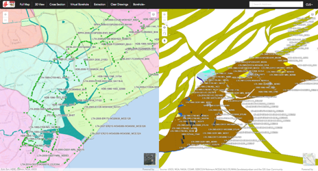
C-01Underground Space Usage3D and VR underground space systems for planning and construction.
C-02Intelligent Water ManagementGeoDashboards that monitor the complete water loop.
C-03Smart TransportNationwide intelligent transport systems.
C-04Smart BuildingIntelligent building management built on BIM.
C-053D City ModellingCity models captured by drone, mobile mapping system and survey.
C-06GIS System MaintenanceOn-site and off-site support that keeps critical systems running.
03CORE OFFERINGS
End-to-end, from architecture to ongoing support
We design the architecture, process the data, build the software and support it in production — on commercial or open-source platforms, locally or on the web.
Explore our services →/01
Geospatial Data AnalysisTurning satellite imagery, geological models, BIM models and survey data into decisions.
/02
GIS System ConsultancyCommercial and open-source GIS, deployed locally or on the web, matched to your security and budget requirements.
/03
3D & Map Base Cloud ServiceMicro cloud services for map and 3D visualisation.
04USE CASES
All use cases →
Proven in the field
FEATURED CASE STUDYHEALTHCAREVPS · AR
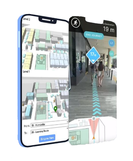
WAI360 for Healthcare Facilities
Patients and visitors find their way through complex healthcare campuses using smartphone-based visual positioning and AR path guidance — without a building-wide beacon installation.
Explore the use case →

05WHY ONE GIS
A partner that understands both the geography and the engineering
Domain expertiseDeep knowledge of transport, utilities, construction, environment and urban planning.
End-to-end deliveryArchitecture design, data processing, software development and ongoing support under one roof.
Qualified GIS specialistsCertified professionals; over 30% hold a bachelor’s degree or higher in geospatial or related fields.
Innovative productsOur own platforms for geospatial AI, navigation and field-service dispatch.
Strong track recordSuccessful deployments with end-users from LTA, PUB, NEA, BCA and healthcare facilities.
Academic collaborationR&D with NTU Civil & Environmental Engineering and Wuhan University.
START A CONVERSATION
Have a geospatial challenge? Let’s map it out.
Speak with our specialists about your data, systems and objectives.